How LaunchPad Helps Landscaping Companies
Measure & Estimate Accurately
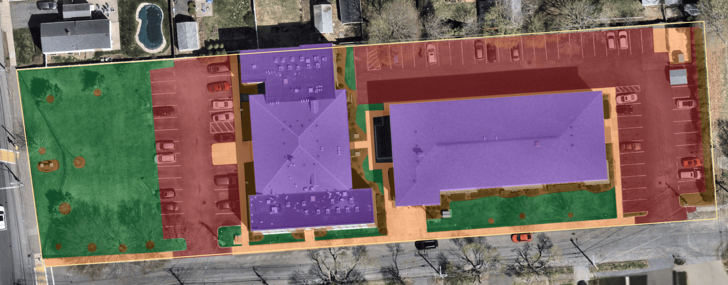
Use LiDAR scans, AI measurements, or uploaded site plans for fast, precise takeoffs and bids.
Centralize Every Property
Store notes, photos, and client requests on one map for seamless handoffs across sales, ops, and account managers.
Win Renewals & Upsells
Document site visits, capture enhancement opportunities, and share progress reports that strengthen client trust.
Stop Losing Time and Money on Landscaping Jobs
What's Holding You Back
Manual Site Walks Waste Time
Multiple trips to measure areas, assess conditions, and create accurate estimates.
Notes & Photos Lost Across Devices
Photos, measurements, and notes spread across different devices and apps—hard to find when needed.
Pricing Errors Hurt Margins
Guessing square footage leads to underbidding projects or losing jobs to competitors.
No Property History for Clients
Difficulty keeping clients updated on project progress leads to dissatisfaction and disputes.
How We Fix It
Fast, Accurate Measurements
Scan with LiDAR, overlay PDFs, or use AI imagery to measure in minutes.
One Map, One System
Every role works from the same source of truth, no details lost in handoffs.
Confident Bids
Precise data ensures profitable pricing and competitive proposals.
Stronger Client Relationships
Keep a history of photos, notes, and site reports to secure renewals and upsells.
Features Landscaping Companies Love
AI & LiDAR Measurements
Scan, measure, and segment properties in minutes.
Property-Centric Records
Every site has its full history of notes, photos, measurements, and documents.
Site Reports & Enhancements
Capture photos and geo-tag upsell opportunities for crystal-clear communication.
Connected Teams
Sales, ops, account managers, and leadership all work from one platform.